|
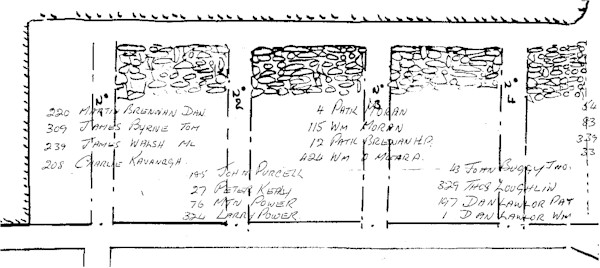
This is part of a large drawing that mapped out the different areas of work at the coal face. It also indicates which miners( and their identity numbers) were working each "Road." It was like the centre of Dublin down under with O' Connell St. being the main road - then off that road you had a network of smaller roads, all working out the seam of coal. |
 |
|
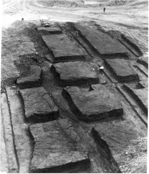
The picture below shows exactly how that "Network" looked. Below you see a coal seam that was originally mined for some time. Years later it was decided to "Opencast" the coal, so all the surface was stripped away with large machinery revealing a cross section view of the seam when the miners left it.
|
|
|